 Tenkawa Village Sightseeing Website
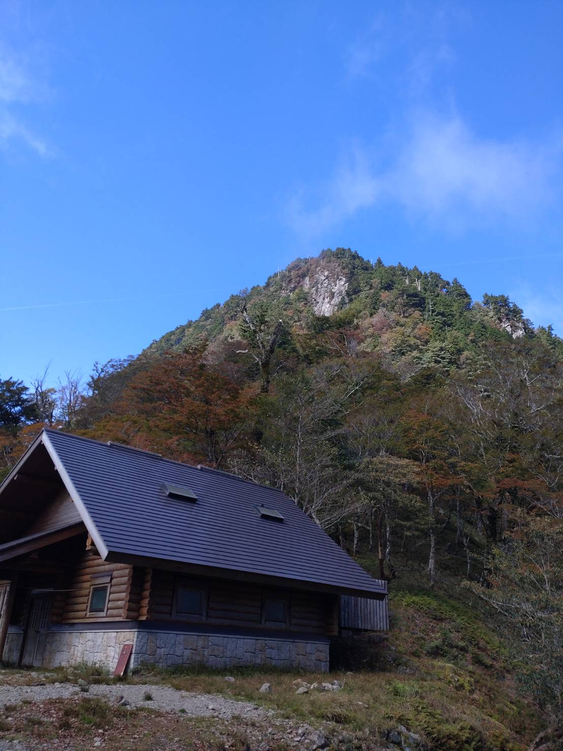
- For Experienced Hikers
- For Intermediate-level Mountain Hikers
Mount Gyoja-gaeri-dake
Mout Gyoja-gaeri-dake, standing at an elevation of 1546 meters, is situated between Mount Daifugen-dake and Mount Misen on the Omine Okugake-michi trail. The southern side of the peak features a precipitous cliff, and the mountain's name derives from the legend that even En-no Gyoja (the founder of Shugendo) once had to turn back due to the challenging terrain. Upon reaching the summit, the Omine Okugake-michi (on the ridge) in this vicinity becomes a comfortably traversable mountain path with relatively gentle ascents and descents, hovering around an elevation of approximately 1500 meters. The trail is adorned with vibrant displays of flora, starting with rhododendrons and continuing with clusters of Shiroyashio (or Goyo Tsutsuji; rhododendron), blossoming abundantly from late May. This creates a flowery corridor featuring species such as Yama Shakuyaku (mountain peony), Kusatachibana (Thunberg's meadowsweet), Baikeso (lesser celandine), Torikabuto (butterbur), and more. Renowned poet, Keigetsu Omachi (1869-1925), is said to have composed a poem during his pilgrimage along the Omine Okugake-michi, specifically in this area. He wrote: “With Mount Misen close in sight, traversing the ridges all day on the Omine Okugake-michi.” He is believed to have inscribed this poem on a large beech tree. A monument bearing this poem stands near the hut. Additionally, just below the rock wall of Mount Gyoja-gaeri-dake, there is the Gyoja-gaeri Evacuation Hut (unmanned), providing a refuge for hikers in need.
Check out “YAMAP” for courses and other details provided by Tenkawa Village staff who walked this route.

Note: When mountain climbing, download a map from YAMAP, and check the course and your location for your safety.
*Take extra care when navigating the steep ascent (with a ladder) section to the summit of Mount Gyoja-gaeri-dake.
*Accessing the route from Okawaguchi is strictly prohibited due to the deterioration of the path and landslides.
【Access】
Along Route 309, there is a parking lot (with a fee) on the west end of the Gyoja-gaeri Tunnel.
Access to the Gyoja-gaeri Tunnel is via a narrow road. On the way, the Shirakura Tunnel has restrictions for vehicles with a height limit of 2.6 meters and a length of 7 meters. Additionally, during the winter season, National Route 309 is closed to traffic from Okawaguchi to Nishihara in Kamikitayama Village.
【How to Use YAMAP】
*When searching for a map, choose the map of “Daifugen-dake, Sanjo-gatake, and Inamura-gatake” that appears by searching for “Sanjo-gatake” or “Inamura-gatake.” Or use the map of “Hakkyo-gatake” that appears when you search for “Hakkyo-gatake” and click on the mountain icon in the search results on the map.


Read rules and manners for enjoying Tenkawa Village